RED RIVER GORGE
The Red River Gorge area of
eastern Kentucky has the highest concentration of natural arches in all of
eastern America. The area has some spectacular scenery and unexpected
topographic relief, which is characteristic of the highly dissected Cumberland
Plateau physiographic province (= Kentucky portion of the Allegheny
Plateau; aka Appalachian Plateau).
Info. on these pages mostly
synthesized from:
Dever & Barron (1986) -
Red River Gorge Geological Area (Daniel Boone National Forest) and Natural
Bridge State Park, east-central Kentucky. Southeastern Section of the
Geological Society of America, Centennial Field Guide 6: 43-46.
Greb & Mason (2005) -
Geology of the Red River Gorge Geological Area and Natural Bridge State Resort
Park. 42nd Annual Meeting of the American Institute of Professional
Geologists Field Trip Guidebook. 43 pp.
Lane & Dubar (1983) -
Progradation of the Borden Delta: new evidence from crinoids. Journal
of Paleontology 57: 112-123.
An excellent coffee table
book that includes many high-quality photographs of this area is: Snell (2006)
- Red River Gorge, the Eloquent Landscape. 168 pp.
NATURAL BRIDGE
Despite its formal name,
this feature is not a natural bridge. In geology, the term natural
bridge refers to rock arches that have a river or stream running underneath
(or even a dry creek). The term natural arch refers to rock arches
that do not have rivers or streams or dry creek beds underneath.
Natural Bridge in Kentucky lacks a watercourse running underneath, and
so is categorized as a natural arch.
The rocks making up Natural
Bridge are cross-bedded, fluvial, quartzose sandstones of the Corbin
Sandstone (Middle Pennsylvanian), as are all the ridge tops and most other
natural arches in the Red River Gorge area.
Location: Natural Bridge State Park,
western side of Rt. 11 & Middle Fork of the Red River, south of Slade,
southeastern Powell County, eastern Kentucky, USA.
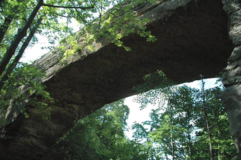
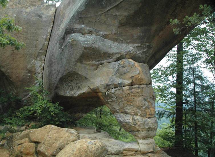
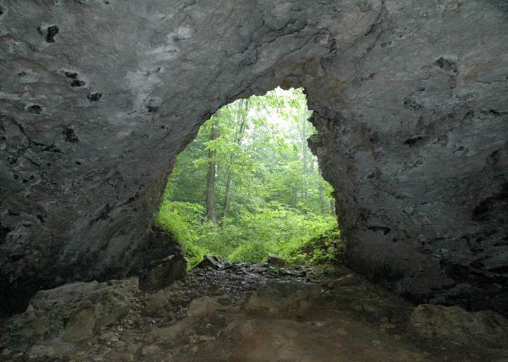
Natural Bridge - a ridge-top natural arch
formed by erosion of vertically-jointed Corbin Sandstone, a cross-bedded
quartzose sandstone unit of Middle Pennsylvanian age.
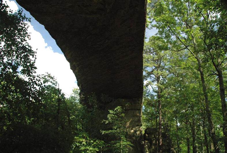
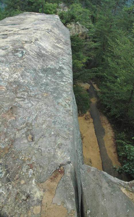
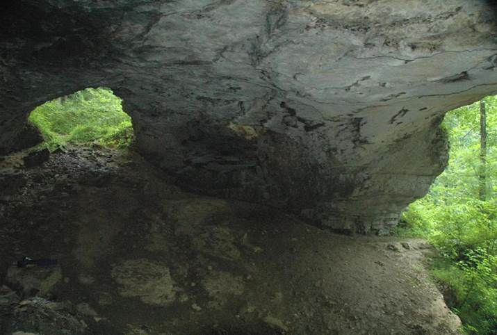
Natural Bridge - note the straight sides
of the natural arch - these are vertical joint surfaces. Undercut narrow
ridges such as this are partly the result of erosive detachment of large blocks
of rock along joint planes.
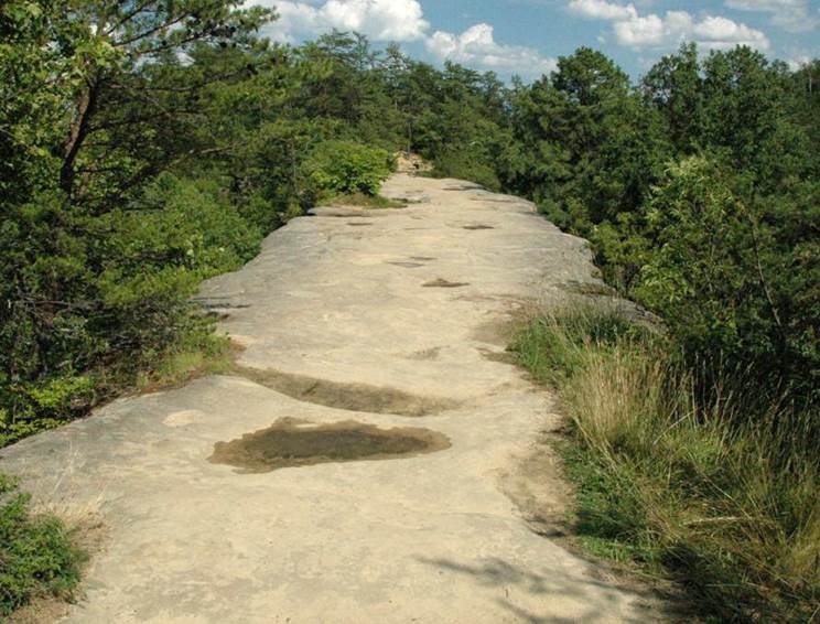
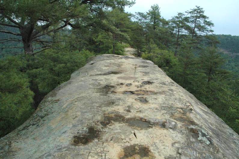
Natural Bridge (roof view) - ridge-top
natural arch developed in vertically-jointed, cross-bedded quartzose sandstones
of the Corbin Sandstone (Middle Pennsylvanian).
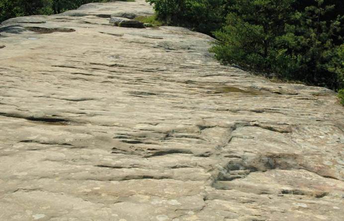
Natural Bridge (roof view) - the
small-scale ridges here are cross beds dipping away from the
viewer. Cross bedding forms in a one-directional current by wind or
water. So, the current that originally deposited these sediments was
moving away from the viewer.
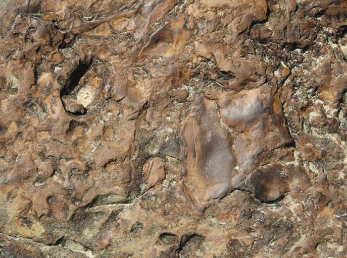
Natural Bridge (roof) - dense, irregular
iron banding in the Corbin Sandstone. The materials making up the
brownish structures here are iron oxides and iron hydroxy-oxides (mostly
goethite). Such iron banding is frequently referred to as “Liesegang banding”.
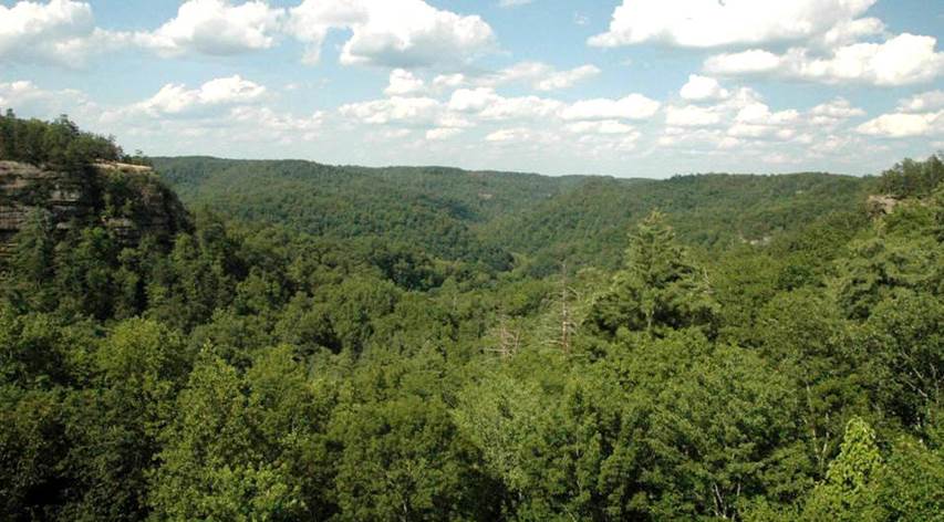
View from atop Natural
Bridge natural arch. Looking ~E. The rocky cliffs seen at the left
& right margins (& in the distance) are Corbin Sandstone, the
same unit making up Natural Bridge.
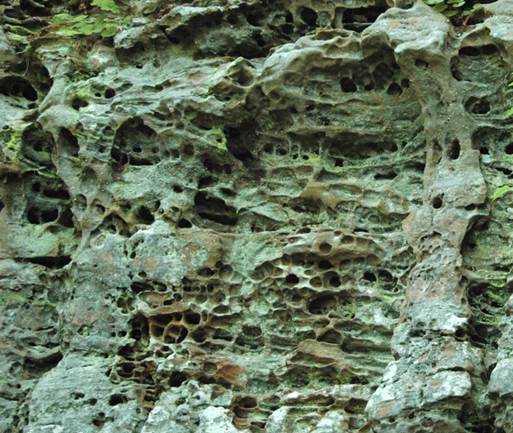
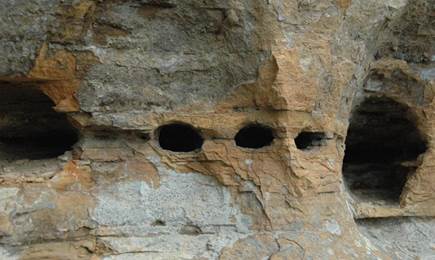
Honeycomb weathering developed in cross-bedded
quartzose sandstones of the Corbin Sandstone (Middle Pennsylvanian). Locality:
Original Natural Bridge hiking trail, a little downslope from Natural Bridge
itself.
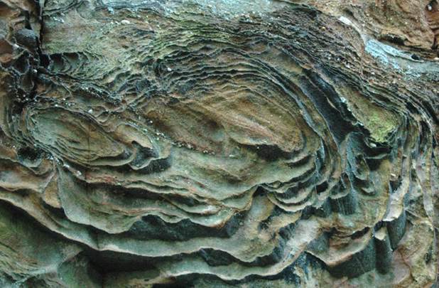
Iron-banding (“Liesegang banding”) in
cross-bedded, pebbly quartzose sandstones of the Corbin Sandstone (Middle
Pennsylvanian). Locality: Balanced Rock hiking trail, downslope
from Natural Bridge.
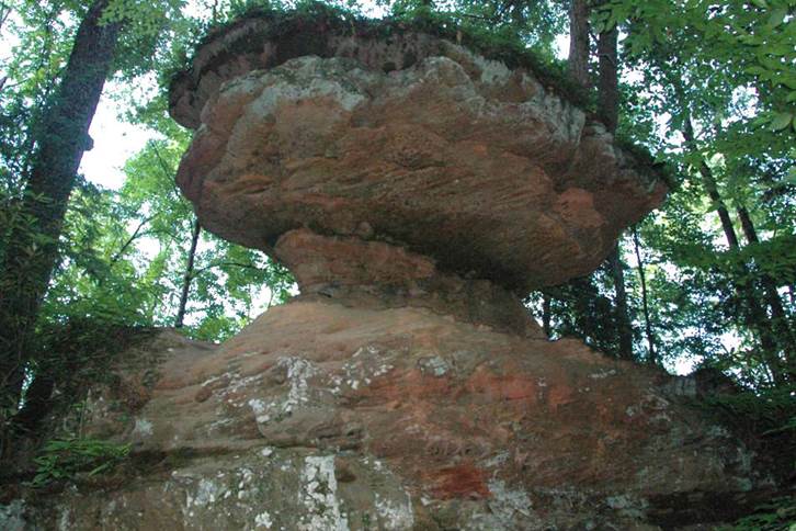
Balanced rock, formed by differential
erosion of cross-bedded quartzose sandstones of the Corbin Sandstone (Middle
Pennsylvanian). Locality: Balanced Rock hiking trail, downslope
from Natural Bridge.
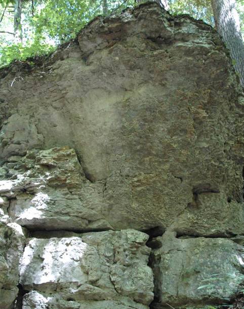
Newman Limestone (aka Slade
Formation) - the next major stratigraphic unit underlying the Corbin Sandstone
seen at the ridge-top. The Newman Ls. is Meramecian to Chesterian in age
(Middle to Upper Mississippian).
Locality: Original Natural Bridge
hiking trail, downslope from Natural Bridge.
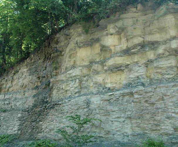
Borden Formation - this thick deltaic
succession underlies the Newman Limestone in the Red River Gorge area.
The Borden Fm. consists of several members. The outcrop shown above
consists of interbedded shales and siltstones of the Cowbell Member
(Osagean Stage, upper Lower Mississippian).
Locality: trailhead area for
Natural Bridge hiking trails.
HENSON'S CAVE
ARCH
Henson's Cave Arch is located
a little east of the Red River's Middle Fork. Unlike most of the natural
arches in the Red River Gorge area, Henson's Cave Arch is not developed
in rocks of the Corbin Sandstone. Instead, it is developed in the Newman
Limestone (aka Slade Formation) (Meramecian to Chesterian Stage,
Middle to Upper Mississippian). It really isn't a natural arch.
It's simply a small cave with an entrance and a skylight.
Locality: just SSE of Whittleton
Campground, eastern side of Rt. 11 & the Middle Fork of the Red River,
southeast of Slade, southeastern Powell County, eastern Kentucky, USA.
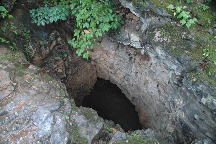
Henson's Cave Arch - main entrance to
cave. The cave is quite small. The passage to the left extends only
a few meters. The hollow on the right has a small waterfall cascading
down the entire height of the pit. Water does not pond at the base, but
percolates further downward through rubble and hidden dissolution conduits.
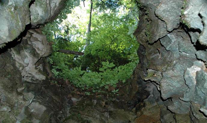
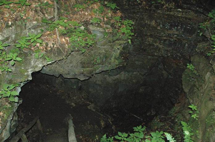
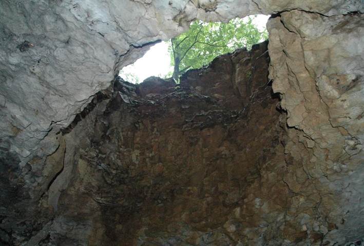
Henson's Cave Arch - small skylight formed by
dissolution (and collapse?) of limestone roof. The walls are irregularly
sculpted with relatively sharp protruding edges (karren weathering).
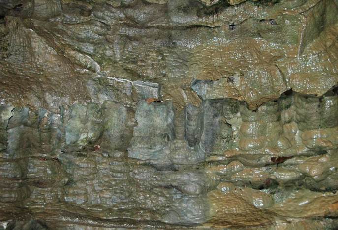
Henson's Cave Arch - walls of Newman Limestone
(aka Slade Formation) (Meramecian Stage to Chesterian Stage, Middle to
Upper Mississippian) having karren weathering, formed by dissolution of
the calcium carbonate rocks by various acids (principally carbonic acid and
organic acids).
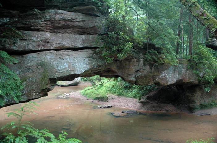
ROCK BRIDGE
Rock Bridge is a great
example of a true natural bridge. Natural bridges are rock arches
developed over rivers, streams, or dry creek beds. They are much scarcer
than natural arches, which do not have watercourses running underneath.
Rock Bridge, developed along Swift Camp Creek in the Red River Gorge area, is
often referred to by the deceiving term "waterfall arch". It is
a true natural bridge, not a natural arch, but it did form after once being a
waterfalls.
The rocks making up Rock
Bridge are vertically-jointed, cross-bedded, fluvial, quartzose sandstones of
the Corbin Sandstone (Middle Pennsylvanian). The lowest roof portion of
Rock Bridge was once the upper platform for a waterfalls along the creek.
While the waterfalls was active, water percolated downward along a joint plane
just upstream of the falls, then moved laterally and emerged from the lower
face of the falls. The within-rock water movement loosened and removed
rock material to the point where the entire stream bypassed underneath the
former waterfalls, forming a rock arch (a natural bridge).
Locality: Swift Camp Creek, just
downstream (north) of confluence with Rockbridge Fork, accessed via Rock Bridge
Road and hiking trail, east from Rt. 715, NNW of Campton, Wolfe County, eastern
Kentucky, USA.
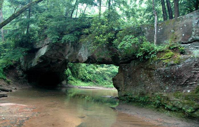
Rock Bridge (looking downstream) - a
scarce example of a true natural bridge with a flowing stream underneath.
The flat-topped portion at upper right is the original upper platform for a
waterfalls. The rocks are Corbin Sandstone.
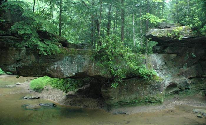
Rock Bridge (looking ~E; stream flows
to the left)
Rock Bridge (looking ~E; stream flows
to the left)

Creation Falls - this scenic waterfalls is
a little upstream from Rock Bridge, within sight of the confluence of
Rockbridge Fork and Swift Camp Creek. The rocks are Corbin Sandstone.
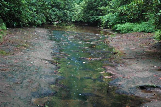
Creation Falls - a small stream of flowing
water immediately upstream from Creation Falls (see above photo) Note
that the stream volume is greater upstream from this small rock platform.
Water is percolating downward along a vertical joint plane, moving laterally,
and emerging from the face of Creation Falls. This is the same
thing that happened at Rock Bridge.
SKY BRIDGE
Sky Bridge is a ridge-top
natural arch on the southern side of Red River. It is developed in
vertically-jointed, cross-bedded, fluvial quartzose sandstones of the Corbin
Sandstone (Middle Pennsylvanian), as are most natural arches in the Red River
Gorge area. It is similar to Natural Bridge in structure and origin, but
Sky Bridge has been more significantly eroded.
Locality: northwestern side of Rt.
715, southern ridge-top along Red River Gorge, near Red River-Swift Camp Creek
confluence, northwestern Wolfe County, eastern Kentucky, USA.
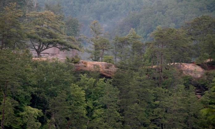
Sky Bridge, as seen from overlook on
northwestern side of Rt. 715. The shape of the natural arch is obscured
by foliage (a better view is to be had in the boreal fall or winter).
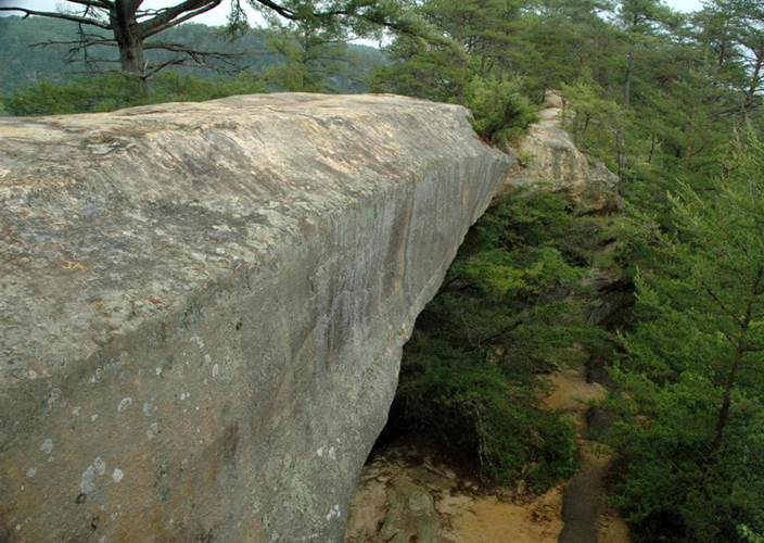
Sky Bridge (western end of natural
arch, looking ~NE). The rocks are Corbin Sandstone.
Sky Bridge (looking ~ENE) - the main
joint plane that defines the southern side of Sky Bridge is a well-developed
crack in the bedrock at the southwestern corner.
Sky Bridge (looking ~ENE) - rooftop of
the natural arch. Water has ponded atop small bowl structures floored by
thick iron bands (“Liesegang bands”).

Sky Bridge (looking ~ENE) - no river
or stream or dry creek bed runs underneath this structure, so it is a true natural
arch, not a natural bridge.
Sky Bridge (looking ~W). Note
the prominent vertical joint plane to the left that defines Sky Bridge's
southern face. Note also the irregular, dark, thin lines of iron banding
(“Liesegang banding”) and the horizon of honeycomb weathering near the top of
the pedestal in the foreground.

Honeycomb weathering (aka cavernous
weathering) in Corbin Sandstone (Middle Pennsylvanian) along cliff face,
immediately east of base of Sky Bridge natural arch.
MOONSHINERS ARCH
Moonshiners Arch is a
partially collapsed limestone cave along the banks of the Red River. The
arch is developed in Newman Limestone (aka Slade Formation) (Meramecian
Stage to Chesterian Stage, Middle to Upper Mississippian). The cave
formerly held an underground stream that drained into Red River. With
regional downcutting, the modern underground drainage occurs at slightly deeper
stratigraphic levels.
Locality: northern side of the Red
River, a little upstream from Rt. 715 bridge over the Red River (= Wolfe
County-Menifee County line), far-southern Menifee County, eastern Kentucky,
USA.
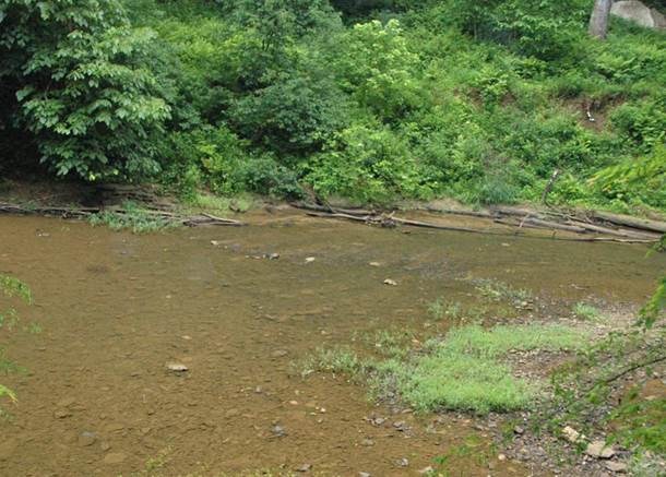
Red River (looking south; stream is
flowing to the right). The unusual scenery and topographic relief of this
part of the Cumberland Plateau was created by erosive dissection by the Red
River and its tributarires.
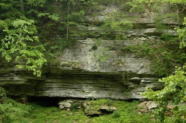
Newman Limestone (aka Slade
Formation) (Middle to Upper Mississippian) forming rocky cliffs along the Red
River.
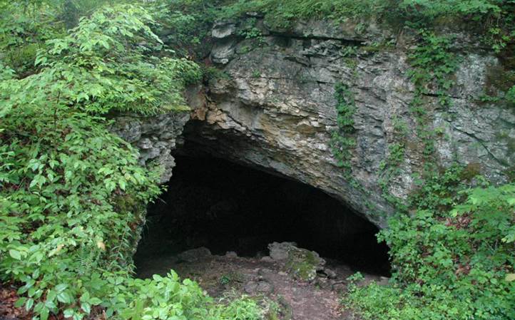
Moonshiners Arch - uphill cave entrance
formed by collapse. The rocks are Newman Limestone.
Moonshiners Arch - downhill cave entrance
formed by river bank erosion.
Moonshiners Arch - uphill cave
entrance. The rocks are Newman Limestone.
Moonshiners Arch - uphill (left) and
downhill (right) cave entrances. The rocks are Newman Limestone (Upper
Mississippian).
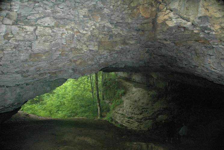
Moonshiners Arch - small skylight formed by
collapse (and dissolution?).
Moonshiners Arch - small skylight formed by
collapse (and dissolution?).
BERT COMBS
MOUNTAIN PARKWAY ROADCUTS
The stratigraphic column of
the Red River Gorge area is most readily appreciated by examination of a series
of roadcuts along the Bert Combs Mountain Parkway between Slade (eastern Powell
County) and Pine Ridge (western Wolfe County), eastern Kentucky, USA. The
section consists of Lower Mississippian to Middle Pennsylvanian sedimentary
rocks. Major and minor unconformities are present in the succession, so
it is not a complete sedimentary record of this time interval.
Generalized stratigraphy (not to scale):
_________________________
Corbin
Sandstone
Middle Pennsylvanian
_________________________
Grundy Formation Lower to Middle Pennsylvanian
(aka Breathitt Fm.,
"lower tongue")
_________________________
Newman Limestone Middle to Upper Mississippian
(aka Slade Formation)
_________________________
Renfro Member
of the Borden Formation Lower-Middle Mississippian boundary
(aka Renfro Mbr. of the
Slade Formation)
_________________________
Nada Member Lower Mississippian
of the Borden Formation
_________________________
Cowbell Member Lower Mississippian
of the Borden Formation
_________________________
Nancy Member Lower Mississippian
of the Borden Formation
_________________________
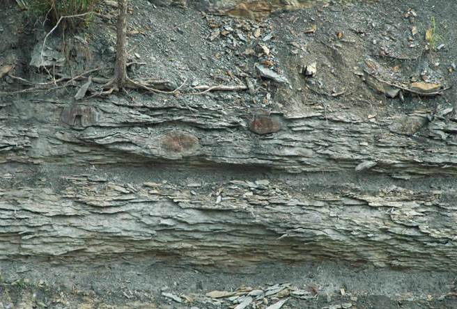
Nancy Member of the Borden Formation
(Osagean, upper Lower Mississippian). The Nancy consists principally of
interbedded siltstones and shales with ironstone concretions (see the dark
elliptical structures above). These sediments were deposited in a
prodeltaic setting. Locality: roadcut along southern side of Bert
Combs Mt. Pkwy, just east of Rt. 11 east-bound entrance ramp at Slade.
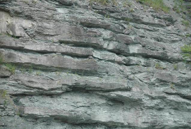
Cowbell Member of the Borden Formation
(Osagean, upper Lower Mississippian). The Cowbell consists of interbedded
shales and siltstones deposited along the front of the ancient Borden
Delta. It lacks the ironstone concretions of the Nancy Member.

Nada Member and Renfro Member of
the Borden Formation. The Nada Member is the partly vegetated slope at
the bottom. The unit consists of soft, quickly-weathering shales
deposited in a delta top setting. The Nada is Osagean in age (upper Lower
Mississippian). The yellowish-weathering unit above is the Renfro Member
(aka a member of the Slade Formation). The Renfro consists of
interbedded argillaceous dolostones and silty dolostones deposited in a
supratidal environment. Published biostratigraphic research has indicated
that the Renfro straddles the Osagean Stage-Meramecian Stage boundary (= Lower
Mississippian-Middle Mississippian boundary).
Locality: roadcut along southern
side of Rt. 15, parallel to & within sight of Bert Combs Mt. Parkway.
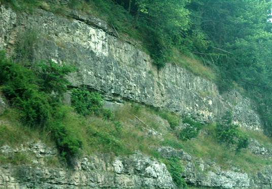
Newman Limestone (aka Slade
Formation) (Meramecian Stage to Chesterian Stage, Middle to Upper
Mississippian). The Newman is a moderately hard, grayish limestone
deposited in an ancient shallow marine carbonate platform setting.
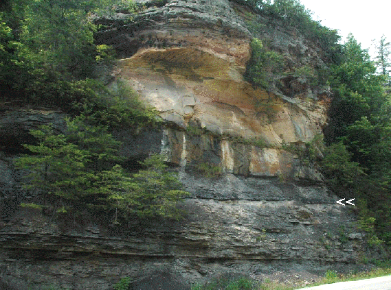
Grundy Formation (aka “lower tongue”
of the Breathitt Formation) (Lower to Middle Pennsylvanian) makes up the lower
part of this roadcut - interbedded shales and siltstones with coal (see white
arrow above). The cliff-forming rocks in the upper part of the cut
represent the lower Corbin Sandstone (sometimes considered a member of
the Lee Formation & aka a member of the Grundy Formation) (Middle
Pennsylvanian).